


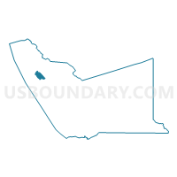
Voting District 41535, Alameda County, California
About
Outline

Summary
| Unique Area Identifier | 528759 |
| Name | Voting District 41535 |
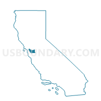
| County | Alameda County |
| State | California |
| Area (square miles) | 3.81 |
| Land Area (square miles) | 3.10 |
| Water Area (square miles) | 0.72 |
| % of Land Area | 81.16 |
| % of Water Area | 18.84 |
| Latitude of the Internal Point | 37.74040820 |
| Longtitude of the Internal Point | -122.20192260 |
Maps

Graphs
Select a template below for downloading or customizing gragh for Voting District 41535, Alameda County, California


Neighbors
Neighoring Voting District (by Name) Neighboring Voting District on the Map
- Voting District 30875, Alameda County, CA
- Voting District 31035, Alameda County, CA
- Voting District 31045, Alameda County, CA
- Voting District 31050, Alameda County, CA
- Voting District 31060, Alameda County, CA
- Voting District 31065, Alameda County, CA
- Voting District 31175, Alameda County, CA
- Voting District 31190, Alameda County, CA
- Voting District 31200, Alameda County, CA
- Voting District 41540, Alameda County, CA
- Voting District 41570, Alameda County, CA
Top 10 Neighboring County Subdivision (by Population) Neighboring County Subdivision on the Map
- Oakland CCD, Alameda County, CA (411,480)
- Hayward CCD, Alameda County, CA (366,577)
- Alameda CCD, Alameda County, CA (73,812)
Top 10 Neighboring Place (by Population) Neighboring Place on the Map
Top 10 Neighboring Unified School District (by Population) Neighboring Unified School District on the Map
- Oakland Unified School District, CA (390,785)
- Alameda City Unified School District, CA (73,812)
- San Leandro Unified School District, CA (68,320)
Top 10 Neighboring State Legislative District Lower Chamber (by Population) Neighboring State Legislative District Lower Chamber on the Map
Top 10 Neighboring State Legislative District Upper Chamber (by Population) Neighboring State Legislative District Upper Chamber on the Map
Top 10 Neighboring 111th Congressional District (by Population) Neighboring 111th Congressional District on the Map
Top 10 Neighboring Census Tract (by Population) Neighboring Census Tract on the Map
- Census Tract 4283.01, Alameda County, CA (6,526)
- Census Tract 4282, Alameda County, CA (6,259)
- Census Tract 4324, Alameda County, CA (5,814)
- Census Tract 4088, Alameda County, CA (5,547)
- Census Tract 4093, Alameda County, CA (5,229)
- Census Tract 4323, Alameda County, CA (4,656)
- Census Tract 4281, Alameda County, CA (4,651)
- Census Tract 4325.02, Alameda County, CA (4,485)
- Census Tract 4094, Alameda County, CA (4,306)
- Census Tract 4271, Alameda County, CA (3,646)
Top 10 Neighboring 5-Digit ZIP Code Tabulation Area (by Population) Neighboring 5-Digit ZIP Code Tabulation Area on the Map
- 94501, CA (60,212)
- 94601, CA (50,294)
- 94577, CA (45,560)
- 94603, CA (31,403)
- 94621, CA (29,870)
- 94502, CA (13,600)